

Real-time Risk Intelligence, on the map you already use
Bent Ear Solutions (BES) Risk Intelligence Feeds, powered by samdesk, detect disruptions from more than one million sources and deliver them as live, confidence-scored ArcGIS layers across six topics, each licensed individually per agency. See evolving incident records on the map instead of hundreds of scattered reports.
Powered bysamdesk (opens in a new tab)
Six topic feeds, licensed one at a time
Each feed covers one kind of disruption. License the ones that match your jurisdiction's risks.
Powered bysamdesk (opens in a new tab)
Emergency and safety
- Detects
- Security incidents that affect public safety or the services your agency runs.
- For a county operations center
- Decide whether an incident nearby calls for a protective action or added patrol coverage.
Infrastructure
- Detects
- Incidents that disrupt municipal services, infrastructure, or utilities.
- For a county operations center
- See which services and facilities are down before the calls stack up, and route resources around them.
Climate
- Detects
- Weather crises that threaten public safety or continuity of operations.
- For a county operations center
- Confirm where severe weather is causing harm on the ground, and decide when to activate.
Health
- Detects
- Public health incidents and disease outbreaks that affect your population.
- For a county operations center
- Give public health partners an early, mapped view of an outbreak so the operations center can coordinate the response.
Geopolitics
- Detects
- Political events that affect public services or infrastructure.
- For a county operations center
- Plan security and service continuity around political events near government facilities.
Cyber
- Detects
- Attacks on systems and networks that affect infrastructure and operations.
- For a county operations center
- Know when a cyberattack hits a utility or a neighboring jurisdiction, and prepare for the service disruptions that follow.
Licensed per agency, per feed. Most agencies start with one to three feeds. Every topic arrives as an authenticated ArcGIS layer that BES hosts and supports.
What an alert looks like on your map
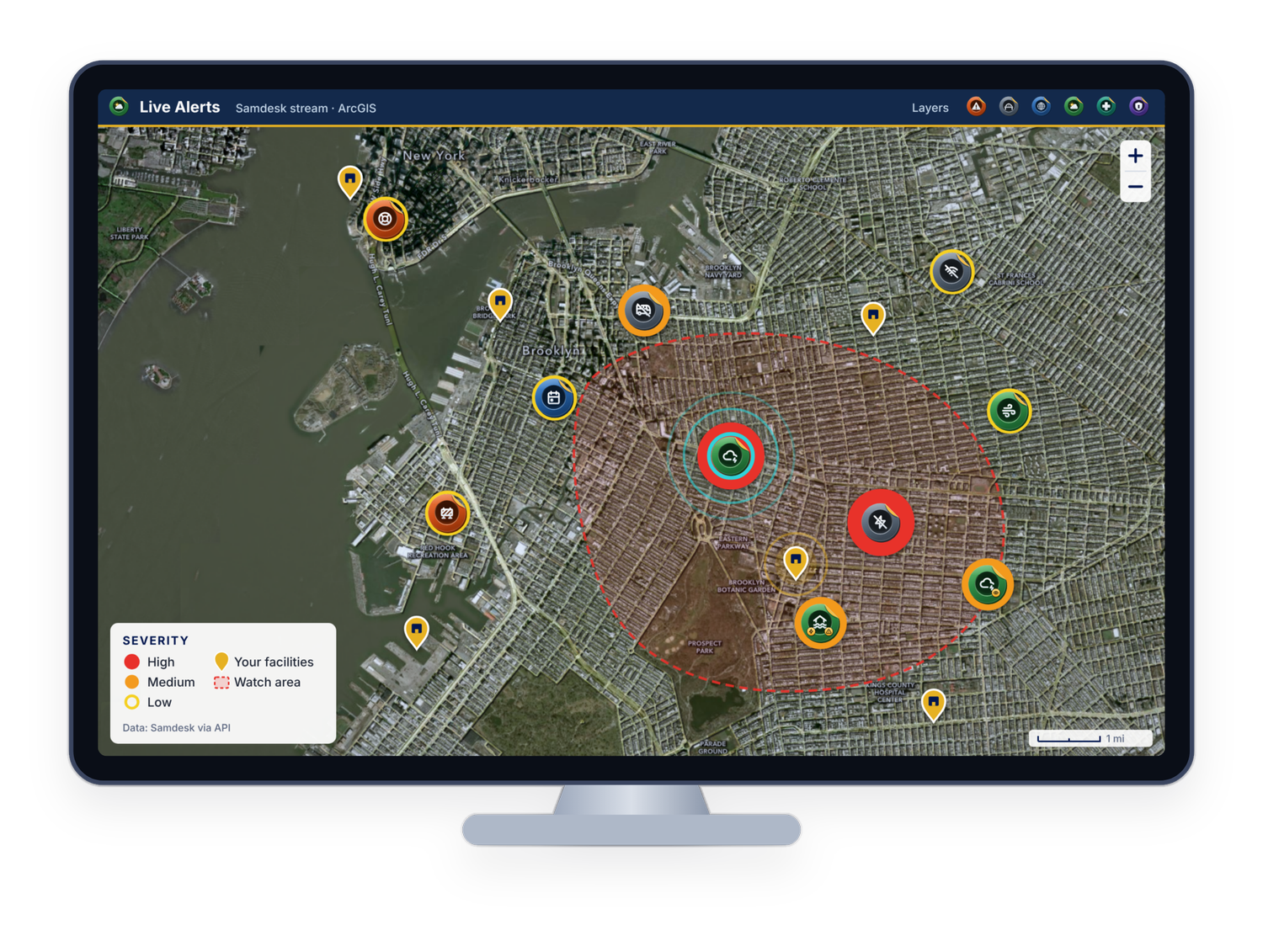
On the map
Each alert sits on your map as a point colored by severity, next to your own facilities and layers, so you can see what is close to what you protect.
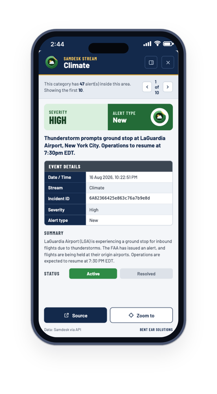
In the details
Open an alert to see what happened, when, how severe it is, and a link to the source, on the operations center wall or on a phone.
How the signal gets cleaned up before it reaches you
Samdesk analysts monitor urgent and developing events around the clock and add context inside each alert as the situation changes.
Reports from where residents post
Samdesk's source partnerships include Reddit, Snapchat, Nextdoor, and Citizen, so first-hand reports reach the feed early instead of after someone calls them in.
Fewer false alarms
AI merges related signals into evolving incident records, each pinpointed and scored for confidence. One rumor doesn't become fifty incidents on your map.
Samdesk monitors more than one million sources and over a billion data points every day.
Questions about Risk Intelligence
A real-world disruption that affects public safety, services, or operations, detected as it emerges and placed on the map. Each falls under one of six topics and arrives as a feature with a location and a confidence score.
Your staff skip the reading. The feed draws on more than one million sources, merges related signals into evolving incident records, scores their confidence, and has analysts verify urgent and developing events around the clock.
Two ways. AI merges related signals into evolving incident records and scores their confidence, so one rumor doesn't become fifty incidents. Analysts then check urgent and developing events around the clock.
Yes. Each of the six topic feeds is licensed on its own, per agency, for a single Esri organization. Most agencies start with one to three that match their biggest risks.
Events are detected in real time, your data feed is refreshed every 5 minutes, and updated as analysts add context or event updates are detected.
ArcGIS Online, ArcGIS Enterprise, and ArcGIS Pro. Each topic arrives as an authenticated feature layer your team can add to web maps and dashboards next to its own layers, or analyze in ArcGIS Pro.
Yes. Request a demo and BES walks your team through the live feeds in ArcGIS, so you can see the layers before you license them. Interested in a trial? Contact us to learn more.